


The Canal System and Bridge Heights in Cape Coral
On the following maps you can see the complete system of freshwater and gulf access canals in Cape Coral and their approximate exit times into the open water. Blue areas are freshwater canals and have no access to open water, but may consist of miles of interconnected waterways. Areas marked in different colors are channels with access to the Gulf of Mexico. The lower maps show all bridges and their heights in all canal systems. Properties located in the South of Cape Coral and west of Chiquita Blvd must also pass through the Cape Harbor boat lock.
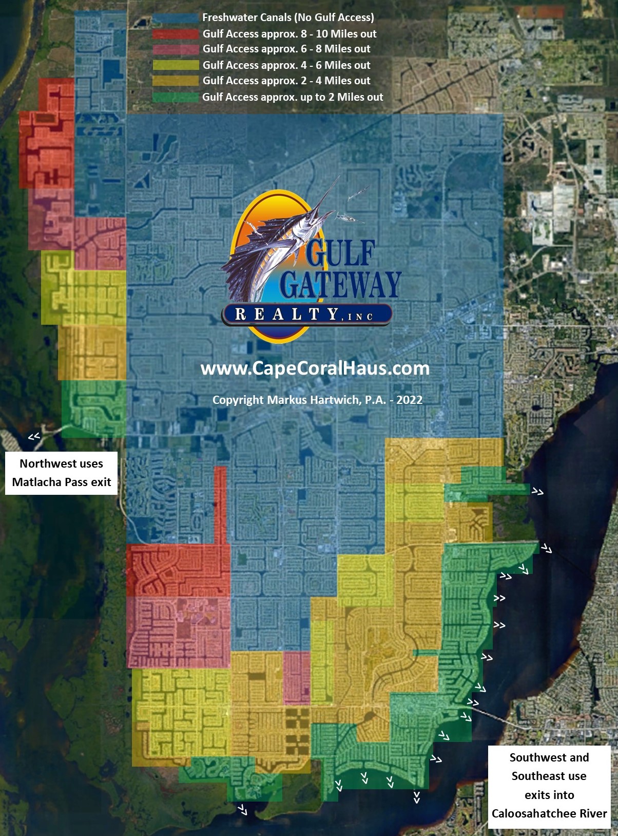
If you would like to download the lower map as a picture (with zoom functionality) please click here.
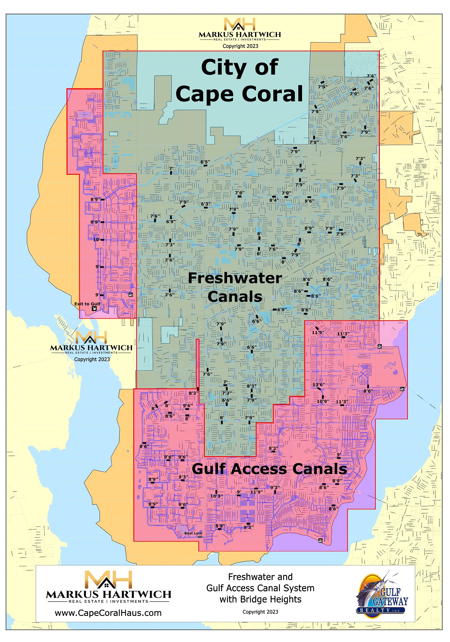
Since the canals that have access to the Gulf of Mexico are of course tidal, you should also inquire whether the boat you intend to purchase can pass the necessary bridges at any desired time. Here is an overview of the tides in Florida.